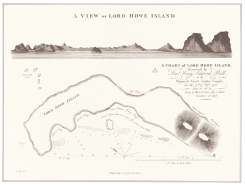
1789 map
Lord Howe Island was discovered on 17th February 1788, by the First Fleet ship Supply.
One of the earliest maps made of the Island is a 1789 map by John Stockdale, England.
Mr Bradley Trevor Greives kindly sponsored the purchase and framing of this map in 2005.